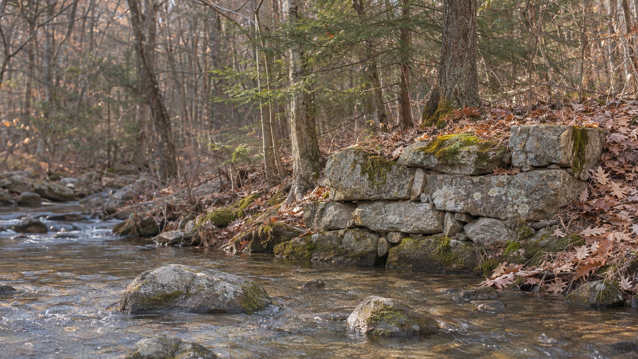
In late October, retired state archaeologist Nick Bellantoni walked part of the Papermill Trail with Madison Land Conservation Trust board member Wendy Schon. Standing over the stone races of an old mill on the Hammonasset River, he said, "You can walk by this all the time and never give it a thought." The trust published the walk in its blog post "Ruined Stones, Ruined Bones," and noted that for much of the year, foliage hides the ruins on many sites, and fallen leaves and settling soil bury them further.
Once the leaves drop, and until snow covers the ground, North Madison's woods show what they were two centuries ago, which was a working landscape. Early settlers cut the forest for charcoal, a forge near Greist Pond burned that charcoal to make iron, and decades later the Hammonasset River powered a paper mill. Each of those industries left a ruin on a trail you can walk today, and taken in that order they tell one story.
The guidebook that put three Madison trails on the map
Bellantoni served as Connecticut's state archaeologist for three decades. He co-wrote "Hiking Ruins of Southern New England" with Barbara Ann Kipfer, and Falcon Guides published it in 2024. Three of its hikes are on land held by the Madison Land Conservation Trust: the Papermill, Ironwoods and Mica Ledges trails. Mica Ledges runs from Durham into North Madison and is owned and managed jointly with the Middlesex Land Trust. The trust booked him as keynote speaker for its Nov. 6 annual meeting at the First Congregational Church of Madison on Meetinghouse Lane.
He was wary of the book at first. "I was really concerned because I spent my career preserving archeological sites, not showing people where they are," he told the trust. "Vandalism is always a consideration." He came around because he decided hikers could help with preservation once they knew the sites were there. "This could create awareness that there are historic archeological sites associated with these trails and that they're significant," he said.
The charcoal came first
The oldest of these ruins are also the easiest to miss. They are flat circles of ground in the woods. At Rockland Preserve, the town-owned land in North Madison west of Route 79, the Town of Madison describes "many circular 'charcoal pits'" with black soil full of bits of charcoal. Next to them are stone fireplaces that mark the rough huts where colliers sat watching the mounds smolder. Early settlers cut the Rockland forest for wood and charcoal, and the old roads they used still cross the preserve: Crooked Hill Road, Poole Road and Dead Hill Road. The preserve's address is 99 Renee Way, and the town lists it as open from sunrise to sunset every day.
Charcoal in Connecticut was mostly made to fuel iron furnaces, and Connecticut Public reported that the state kept producing it into the early 20th century. The mounds were about 30 feet across, and according to UConn geographer William Ouimet, each one took one to two acres of cleared forest. In a December 2016 Connecticut Public report, Ouimet said airborne lidar scans had located about 26,000 of these sites statewide so far. On the scans, they show up as rings or platforms under forest that grew back.
That lidar method is coming to Madison this winter. The land trust's events page lists a December "Lidar Hike" on the Neck River Trail, where the group will use lidar to find charcoal mounds. The date and time will be posted on the MLCT events page. The Neck River Trail starts on Opening Hill Road. The outer loop and back is 1.1 miles, with another 0.1 mile to the junction with the Blinnshed Ridge Trail, and the route runs through pine and spruce, oak-hickory woods and along the Neck River.
You can see a charcoal site at Mica Ledges without any equipment. The trust's Mica Ledges trail guide says Selectmen's Path "passes directly through the remains of an old charcoal mound." The spot is a nearly circular patch of dark soil with charcoal fragments and very little growing on it, 425 feet west of the junction toward the Mattabasset Trail. Along the way, a cairn on the Mattabasset marks the point where Durham, Madison and Guilford meet. The trailhead is at the end of Cream Pot Road in Durham. Of the preserve's 100 acres, 17 are in Madison, and walks run from about 1.2 to 2.5 miles over granite ledges, past Pyramid Rock and down toward Whitney Pond.
Where the charcoal went: the North Madison Iron Works
Charcoal was the fuel, and the Ironwoods Preserve off Race Hill Road shows what it fueled. According to the land trust, Henry Hill, Joseph Pyncheon and Redad Stone bought a four-acre mill site on Joshua Blatchley's farm in the late 1700s. They ran it as a sawmill for two or three years and then turned it into an iron works, which did well until about 1820. By then the bog iron ore and the wood for charcoal that were easy to reach had largely run out.
The operation was small. The Ironwoods page describes a forge hearth about 3 feet square in a 16-by-30-foot forge building, with a 14-by-22-foot charcoal house beside it. A waterwheel ran a large bellows and a heavy trip hammer. Workers fed washed lumps of bog ore "the size of ping-pong balls" into a fire of about 2,600 to 2,700 degrees. After about six hours, each batch became a spongy lump of iron weighing 30 to 40 pounds, which was then hammered into bars. The melted impurities were raked off as slag, and the trust says "tons of that slag still litter the site."
The bog ore itself came from the bottoms of ponds and swamps like the ones on this trail. Iron-fixing bacteria in decaying swamp plants form the deposits, which are reddish or dark brown and run 20 to 50 percent usable iron. According to the trust, the ore can build back up in 5 to 25 years. The loop is about 1.7 miles round trip and takes 1.5 to 2 hours. It crosses open meadow, a dry rocky ridge and wet bottomland on the way to Greist Pond and the forge foundation.
The river's second industry: the Hammonassett Paper Mill
About 45 years after the forge closed, the Hammonasset River was put to work again. The Hammonassett Paper Mill on the Madison side of the river, off Green Hill Road, was built around 1865 and made strawboard, which was used for boxes. The trail guide says strawboard was popular between the era of rag-based paper and the era of wood-pulp paper. The mill did well until it closed in 1890, and a lumber operation later used the site. The mill is listed on the National Register of Historic Places.
This ruin is the easiest of the three to read on the ground. On the Madison side you can see the fieldstone walls of the mill complex, stone-lined head and tailraces, and large footings with threaded iron rods that probably anchored machinery. Deep pits in two of the buildings may have held vats. On the Killingworth bank across the river are the remains of the stone dam, 20 feet long, six feet wide and 14 feet high. There is no wheel pit, because the mill ran on water-driven turbines. On the walk with the trust, Bellantoni pointed to a narrow channel that could pass for a wheel slot. He said turbines were replacing waterwheels in the mid-1800s and were the more likely power source.
Electricity ended the mill's era. By the early 1900s, factories no longer had to sit beside rivers, and the trust says the dam was probably washed out in the Hurricane of 1938. The mill pond then drained and returned to its natural state. A tree now grows where the river's water once ran the mill.
Bare branches also open up the view on this trail. From the crest of Cedar Knoll, just past the red cedars, the trail guide says the view of the river and its floodplain is best "especially in fall, winter and early spring." On gray days, the nearly white upper branches of the big sycamores along the riverbank stand out against the rest of the woods. From Trailhead 1 to Trailhead 2 and back is 1.9 miles, and the south loop adds another mile. Plan on about two hours with stops at the mill and the knoll. Park on Fawn Brook Circle near Green Hill Road, at the cul-de-sac on Wickford Place, or on Hammonassett Meadows Drive.
Before you head out
The land trust lists its hours as dawn until dusk, and its land use policies page covers visiting its trails. Rockland Preserve is town land and has its own Town of Madison page.
| Trail | Start | Distance | Ruin to look for | Cold-season note |
|---|---|---|---|---|
| Papermill | Fawn Brook Circle, Wickford Place or Hammonassett Meadows Drive | 1.9 miles out and back, plus a 1-mile loop | Strawboard mill, races, dam stones | Cedar Knoll river view is best with the leaves down |
| Ironwoods | Race Hill Road, west side | About 1.7 miles round trip | Forge foundation and slag near Greist Pond | Parking area is not plowed in winter |
| Neck River | Opening Hill Road | 1.1-mile loop | Charcoal mounds | December lidar hike, date to be announced |
| Mica Ledges | Cream Pot Road cul-de-sac, Durham | 1.2 to 2.5 miles | Charcoal mound on Selectmen's Path | Steep ledge sections |
| Rockland Preserve | 99 Renee Way | Old roads and Coan Pond | Charcoal pits and collier hearths | Open sunrise to sunset daily |
Ironwoods needs the most planning. Its parking area on Race Hill Road is not plowed, so go there while the ground is still bare. For a walk with no ruins, Rockland's Coan Pond is part pond and part fen, and the town says beavers, turtles and frogs live there. For more places to walk once the beaches close, see our guide to outdoor things to do near Madison and the Shoreline. For the shore side of the off-season, see what changes at Hammonasset after Labor Day.
Green Hill Road, Race Hill Road, Opening Hill Road and the side streets near these trailheads are some of North Madison's quieter corners. If one of these walks has you wondering what a home on these back roads is worth, or what's for sale near your favorite trailhead, Claire Kilmer would be glad to talk it through over coffee. A good place to start is her free home valuation.